GIS Division - City Mapping

GIS stands for Geographical Information Systems
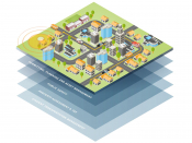
Geography refers to anything that can be located in physical space, primarily those features on the earth's surface. Information Systems is a computer-based technology that stores, retrieves, edits, analyzes, and publishes geographic information.
GIS integrates computer hardware and software to store, edit, and manage data. It integrates data attached to specific locations, allowing us to connect where things are with descriptive information about those locations.
Click the link below:
for the
City's Interactive Map
First City Mapping

What does the City's GIS contain?
The City's GIS contains over 80 databases of information about the infrastructure owned by, cared for, or otherwise related to the City of Leavenworth. That includes addresses:
- 911 information
- buildings
- streets
- boundaries
- properties
- zoning
- subdivisions
- hydrological data that includes creeks, Missouri River, FEMA flooding
- asset inventory, utilities like stormwater, sanitary sewer, and water features,
- topography
- census data
- and much more!!!!

Our GIS helps to serve many of the City's departments by providing maps and websites for the 911 system, dispatch, police and fire, trash pickup, snow removal, and more.
For information about information like property ownership, valuation, or GIS data about properties outside the city limits.
Leavenworth County GIS |
Mitch Braget
GIS Coordinator
GIS Work History: Mitch has worked in the GIS field for six years; previously working for a non-profit organization before leaving and coming to work for the City of Leavenworth in May of 2020 as a GIS Technician. In March of 2022, Mitch was promoted to GIS Coordinator.
Education: Mitch attended and graduated from the University of North Dakota with a Bachelor of Science in Geography in 2015. After graduating with his bachelor's degree, he then attended and graduated from Kansas State University with a Master's in Geography in May 2017.
Heather Gabbert
GIS Technician II
GIS Work History: Heather has worked in the GIS field for 2 years, she has worked for the City of Leavenworth since February 2019 being hired in the Inspections Division. She was promoted to GIS Technician I in May of 2022. Before working for the city, she worked in the retail industry as a manager and tile wholesale industry as a product specialist.
Education: Heather attended and graduated from the University of Kansas in December 2011 from the School of Architecture, Design and Planning with a BFA in Design. She recently graduated from Northwestern Missouri State University in August 2024, with a Master of Science in GIS.
